Great Lakes Distillery, Milwaukee
Welcome to stop #137 on the Brews and Choos project.
Distillery: Great Lakes Distillery, 616 W Virginia St, Milwaukee
Train line: Amtrak, Milwaukee Intermodal Station
Time from Chicago: 89 minutes
Distance from station: 1.3 km
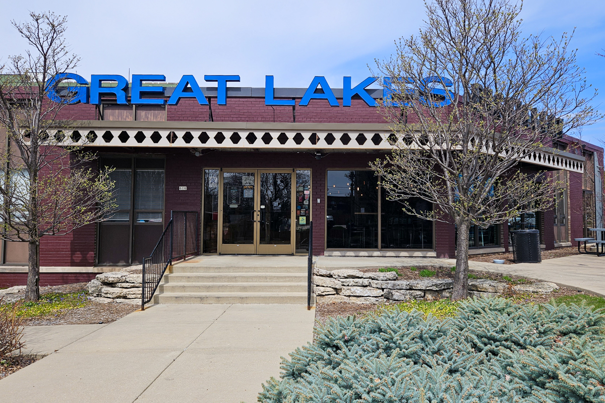
My Brews & Choos Buddy once again rain the Milwaukee Half Marathon this past weekend, so I met up with her after the race for a couple of Brews & Choos stops. All three stops were great, starting with Great Lakes Distillery just south of the train station.

Since she doesn't like neat spirits, she had a floofy drink ("to recover from the race") instead. But before I sampled the spirits, I got us some food from Fox Den, which has a window into the distillery tasting room. My goodness, their Plain Jane burger—nothing more than two smash patties and two slices of American cheese on a brioche with no sauces or nothin'—may have been the best burger I've ever had. My buddy had El Chupacabra, their house-made vegan smashburger, which she loved. And we had a basket of fried cheese curds whose squeakiness survived the fryer. Much yum. Many calorie.
Samples of their spirits are about 10 mL and cost $1 each. I tried the basic Rehost Gin (88 proof), with lots of juniper on the nose nose, nice botanicals, not astringent; "would sip." The Still & Oak 6-year bourbon (90 proof) was delicious, with a nice sweetness, and lots of oak from the barrel. The Rehorst Barrel Aged Gin (94 proof), also excellent, had complex oak, juniper, and even molasses notes that would make a great drink over ice.
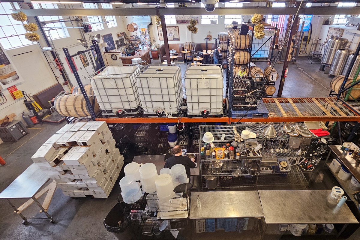
The distillery also has tours and a wide variety of social activities in the evenings. Walking over the bridges on S 6th St over various canals and railroad tracks does not give one warm feelings before entering the historic Walker's Point neighborhood. Once you get to the other side, though, it starts to make sense. Having a place like Great Lakes right there would make the area much more fun.
Beer garden? Yes
Dogs OK? Outside only
Televisions? Avoidable
Serves food? Delicious smashburgers and apps
Would hang out with a book? Yes
Would hang out with friends? Yes
Would go back? Yes
NB: This is the first Brews & Choos review since the 5.0 release in January, so this is also the first review done entirely in Markdown. It was much easier to edit than the old HTML versions, I must say.
Pinned posts
- About this Blog (v5.0) (1 month)
- Brews and Choos project (3 months)
- Chicago sunrises, 2026 (3 months)
- Inner Drive Technology's computer history (2 years)
- Logical fallacies (6 years)
- Other people's writing (5 years)
- Parker Braverman, 2006-2020 (5 years)
- Style sheet (9 months)
- Where I get my corn-pone (2 months)
As long as the trains are running reasonably on-time today, the Brews & Choos Project will be spending some time up here:
Unfortunately, Shotz Brewing does not have a taproom.
James Fallows has a can't-miss post (part 1 of 2) outlining the post-WWII history of US/Iran relations:
Almost as soon as World War II ended, the US began sizing up regimes around the world on whether they were “with us or against us,” in the global struggle against the Soviet Union and global communism. This eventually led to open or covert US alliances with the likes of the Diem family in Vietnam, the Marcoses in the Philippines, Batista in Cuba, Somoza in Nicaragua, Syngman Rhee in Korea, Chiang Kai-Shek in mainland China and then Taiwan, and many more.
In Iran, this global struggle led the US to a fateful turn in 1953. In the early 1950s, Iran had a nascent democratic moment. A Western-educated lawyer, professor, politician, and government official from a prominent family, named Mohammed Mossadegh, was elected prime minister in 1951. Soon some of his “reform” efforts upset the US and the UK. The most dramatic was his nationalization of the Iranian oil industry, then largely controlled by British companies.
Thus in 1953, the CIA, with help of British intelligence, orchestrated a coup to overthrow him, and transfer governing power to the Shah. The CIA’s role in this coup is not speculation or conspiracy theory.
Why does this matter now? Boosters of Trump’s Iran war think they are sounding history-minded when they say they’re finishing a battle that has been going on “for 47 years.” Meaning that, in their minds, the first strike was when Iranian students and protestors took US diplomats hostage, under Jimmy Carter, in 1979.
Very few of today’s Iranians would have any living memory of the CIA-Mossadegh coup. But in my experience, and based on everything I have heard and read, the date “1953” remains as resonant in Iran now as “9/11” still is for most Americans, or “December 7, 1941,” for my parents’ generation.
When did the US-Iran war “start,” from most Iranians’ perspective? Not 47 years ago, but 73.
It's well known how little Americans know about history. And it's human nature that Americans, who care so little for it, have a nearly impossible time understanding that most of the world thinks about history all the time.
The Ayahtoldyouso
Happy Friday! Or not...
- Because the OAFPOTUS and his droogs dismantled "every information weapon we had," Iran has positively killed us in the meme war.
- It's all part of the OAFPOTUS failing to win at anything because he really is a loser.
- So, naturally, we can expect him to steal or destroy all the records of his losing.
- Julia Ioffe expresses some alarm after Defense Secretary Pete Hegseth fired Army Chief of Staff General Randy George.
- It's all part of the debasement of US military standards, writes Brynn Tannehill.
- Despite—or, let's face it, because of—the US backsliding deeper into "flawed democracy" territory, the world democracy index actually increased in 2025.
- Climate change will continue to make flooding in Chicago worse, though we're much better off than we would have been without the Deep Tunnel project.
Well, isn't that special! And it's why tomorrow will be a fun field trip, during which I hope not to think about anything going on around the White House.
Learning some cool new stuff
First, I'm pleased to see that Jeff Maurer came to the same conclusions about the 25th Amendment that I did: It's way harder than impeachment. But it's good that Democrats are talking about it.
At the office today I've spent a lot of time digging into my boss's favorite note-taking product, Obsidian. I also spent a good bit of time with the Claude Code documentation, with an eye to speeding up some development tasks I've got in Jira. I may have more to say about these things later on.
Right now, though, I need to wind up my workday and fetch Cassie from day care. She doesn't know it yet, but she's going to sleep-away camp this weekend, so I can go on a Brews & Choos trip on Saturday. Stay tuned.
Everyone ate Mexican last night
Holy hell, did you see the size of that TACO yesterday? After publicly threatening massive war crimes against Iran, the OAFPOTUS backed down last night, instead offering a two-week cease-fire and conceding that Iran now controls the Strait of Hormuz. Of course, the OAFPOTUS claims this was a great victory, but so does Iran—the country that has its thumb on 20% of the global petroleum trade.
As one can imagine, people here and abroad have reacted poorly:
- Brian Beutler has 25 thoughts on the humiliation of the OAFPOTUS, and a follow-up entitled "Republicans chose Armageddon over checking Trump—they just got lucky" this morning.
- Sam Kahn: "Ceasefire is a big word for backing down"
- Jennifer Rubin: "What comes from the failure to confront insanity?"
- Paul Krugman: "Ignorance and ignominy: Our Hormuz humiliation was not an accident."
- Adam Kinzinger: "We punched Iran. And then we ran."
The New York Times also has an explanation of how the OAFPOTUS got us into this mess, and it's everything we've come to expect from the demented geriatric narcissist.
And yet, that's not the only thing that happened recently:
- Since Arizona rushed implementation of Republican changes to Supplemental Nutrition Access Program (SNAP) benefits in the stupidly-named law from last fall, nearly 47% of the state's participants—including 180,000 children—have lost their food benefits.
- Immigration and Customs Enforcement has spent months harassing California resident Francisco Longoria, during which time they "lied to the public, they lied to obtain an arrest warrant, and they likely lied in both immigration and federal court."
- It took two years from the Watergate break-in before President Nixon finally resigned, but there's a model there for how to pressure the OAFPOTUS into retiring before 2029.
And finally, one of the few remaining old houses in Chicago's Sheridan Park neighborhood is headed for destruction to make way for condos. In theory, making valuable land produce more wealth by changing what's on it makes a lot of sense, but I hate to see these old houses torn down.
Quit fantasizing about the 25th Amendment
Guys, seriously, get it straight:
- The 25th Amendment is the mechanism for the cabinet to remove the president, or for him to remove himself temporarily.
- Impeachment is the mechanism for Congress to remove the president. Right now, we would need two House Republicans to vote for articles of impeachment, and then 20 (!) Republican Senators to vote to convict him.
The only way for Congress to remove the president under the 25th would be for "such other body as Congress may by law provide" to find the president unfit for office. Do you think the OAFPOTUS would sign that law? So then you need 2/3 of both houses to override the veto, and even after all that, the president has 21 days to object to the finding.
He's only leaving office before the end of his term feet-first, or if 22 Republicans suddenly decide they care more about the country than their next primary election. So far, they haven't. And while I'm pretty sure the Democrats will take both houses of Congress this fall, there is no path to a 2/3 majority in the Senate.
Quit fantasizing and start resisting.
This all happened too
I was so busy today I haven't had time to read through all of these:
- Josh Marshall reminds everyone that the OAFPOTUS and his spawn have a lot more money tied up in Saudi Arabia than in Israel, so maybe pay attention to what Prince Mohammed bin Salman has been saying to him about Iran?
- Brian Beutler wants elected Democrats to try acting like an opposition party by, for example, starting an impeachment debate to force Republicans to take sides on the OAFPOTUS's demented behavior.
- Adam Kinzinger praises the effort to rescue the downed officer in Iran over the weekend while simultaneously condemning the war itself: "You can be genuinely, deeply proud of what those service members did — and simultaneously believe this overall Iran operation was launched recklessly, without adequate planning, without allied buy-in, and by a president who clearly did not foresee what would happen next."
- Via Bruce Schneier, the New Mexico trial that ended with a $375 million verdict against Meta does not bode well for your online safety.
- Chicago's downtown office vacancy rate hit a record 28.6% last quarter.
- United Airlines has floated permanent fare increases to offset temporary fuel price hikes, and Cranky Flier is not pleased.
Finally, Illinois had a warm and wet March that included the earliest-ever 32°C (90°F) temperature in Springfield on March 26th. The previous record was 5 May 1943.
And here we go.
I've just scheduled movers for May 5th. That's just over 29 days from now. Cassie will start to see boxes piling up, which she does not like at all. I don't like it either.
Worse, probably 2/3 of my stuff by volume will go into storage for a year while the two of us live in an apartment approximately 1/3 the size of our house. There are very good reasons for this, the primary one being that the very same real-estate market making it exactly the right time to sell my house is also making it exactly the worst time to try buying something else. I'm hoping that the market will stabilize over the next year. So are a lot of people. Or if nothing else, that a cute little 2-bedroom vintage walk-up goes on the market next January for a price I can afford and in a part of Chicago I want to live in.
That's next year. More immediately, I have to start packing for real. Plus handle another 300 small tasks in the next four weeks. Should be fun.
Cassie and I met up with her friend Kelsey and one of my friends at St James Farm Forest Preserve again. We had cool weather under blue skies, perfect for a 6 kilometer walk.
Kelsey was very happy to see me when I got to my friend's house:

And, as usual, both dogs were so excited to be out in the muddy forest preserve that all my friend and I looked at for long stretches were fuzzy dog butts:
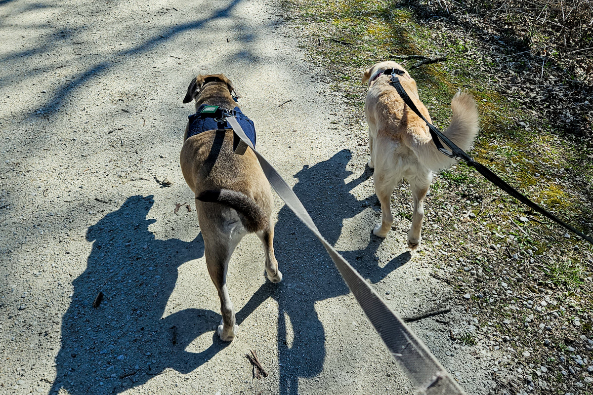
The girls got about half an hour of off-leash time, some of it involving a big stick that Kelsey found. Then they got a special Easter dinner of ground beef and cornbread. Cassie will be overjoyed tonight to discover that there were leftovers.
It was a nice break from everything else going on in the world. More on that this afternoon, I'm sure.
Ladies and gentlemen, I give you the leader of the free world in all his demented glory:

We just need two Republican representatives and 2/5 of the Republicans in the Senate to yank his ass from the Oval Office. Somehow, though, proudly and profanely announcing his intentions to commit war crimes is not disqualifying to the Republican Party.
Via Bruce Schneier, security researcher K. Melton thinks about how to apply computer security concepts to human brains:
Originally, my intention for exploring the concept of “Reality Pentesting” was to create a framework for how we might run adversarial-minded security tests against human perception. At the time of this write-up, I have mapped the topological attack surface, correlated security testing domains with cognitive analogs, and identified several issues we must resolve before deploying such a framework. I am continuing my research, conceptualization, and collaboration in earnest. What follows here is a summary of the field topology of human cognition: a five-layer model of the human cognitive field, its attack surfaces, and a proposal for what proactive defense might look like.
Before we map the attack surface, it’s worth understanding the strategic context.
Yuri Bezmenov was a KGB propagandist who defected to North America in the 1970s. His warning was stark: the United States was already fighting a war it didn’t know it was in. While Americans obsessed over Soviet-flavored spy thrillers, the KGB was in fact allocating 85% of its resources to long-term psychological warfare called “ideological subversion” and “demoralization.”
The goal was to erode democratic society’s ability to agree on what is real. The plan required decades of patient effort: just slowly, systematically degrading the population’s capacity to process information and reach sensible conclusions. The scale came from the length of time estimated to compromise the thinking of at least one generation.
A demoralized population, Bezmenov explained, can be shown true information and still reject it. Facts stop mattering once the epistemology is broken.
I found Menton's essay fascinating.
Attorney General Pam Bondi is out:
President Trump fired Attorney General Pam Bondi on Thursday, removing the nation’s top law enforcement officer as his frustration with her job performance deepened, according to a person familiar with the decision.
We will have to answer the obvious question, "why now?," later. Let's just take a moment to watch the door hit her ass on the way out. Without serious consequences, of course; in that way, the OAFPOTUS has her back.
She can write her book now.
My application for my next apartment was provisionally accepted, pending the criminal background check. First, I have never been charged with a crime, so it should not be a problem. Second, whatever happened in Helsinki that one time, I had no way of knowing she was a Soviet spy.
Of course, without a signed lease, I can't schedule movers or painters. Nor can I have complete certainty about which furniture to store and which to move, so I can't really start packing that much. With my house closing in 41 days, we still have some time before these things need nailing down. I just really don't like it.
I did measure the new place yesterday as the building has an identical unit that's vacant. The most important stuff will fit. And I'm allowed to paint, as well as swap out their bare-bones thermostat for a Nest device, as long as I restore the apartment to factory settings when I move out. (My painter loved this idea when I emailed him last night.)
I do fine with uncertainty in most situations. Not knowing where I'll live in five weeks, though...that's not fun. And it's really interfering with my creativity: I have a ton of updates to the blog software as well as to Weather Now in the queue, and no head space to implement them.
Since I've already sold my house, it seemed prudent to find somewhere else to live. I believe I have. I put in an application for a small apartment with some interesting amenities, not least of which is this view:

More information when available. Meanwhile, after I explained to Cassie that we would be moving in a few weeks, she reacted as I expected:

April Fool's Day is cancelled
As long as the OAFPOTUS stays in office, the world stupidity quotient will remain too high for effective April fooling. I mean, just look at all this:
- The OAFPOTUS has declared victory in Iran by capitulating to everything Iran demanded and pretending they're not laughing at us. If only we still had allies, yes?
- The Strait of Hormuz has remained effectively closed since February 28th, which matters because we're now receiving the last oil shipments from before the war. Hello $200 oil.
- Despite Iran's well-documented terrorism campaigns of the past, the OAFPOTUS's droogs have decided to spend antiterrorism resources going after the non-existent "Antifa" groups, because fascists generally don't like anti-fascists.
- As the Department of Homeland Security continues to act like the OAFPOTUS's personal Sturmabteilung, Radley Balko is working on an updated edition of his book The Rise of the Warrior Cop. Says Balko, "as I’ve looked into these cases at a more granular level while researching the new edition, I’ve been struck again by just how pervasive, depraved, and diabolical the lying has become. They lie about everything. When they’re caught in a lie, they lie again. They lie when the facts aren’t on their side, but also when they are. And they never, ever admit that they lied."
- The usual pattern of Republican administrations breaking just enough that Democratic administrations spend the first two years fixing them may not work this time around, so maybe we need a more radical approach in 2029? Or even 2027?
- Matt Yglesias points out the obvious problems with billionaires.
- Jennifer Rubin has some good news after last weekends third No Kings protests topped the second iteration as the biggest mass protests in US history: mass movements do topple autocracies.
- Jeff Maurer wants us to admit that "Kamala and Hillary sucked:" "[F]emale candidates become viable if you accept one simple truth: Hillary and Kamala both kind of sucked as candidates."
Finally, in honor of the holiday, The Daily WTF has a corporate language compliance generator free to use. It's hard to argue with the mission statement: "With blockchain, we are agentically communing executive assistants to forging AI-forward cross-collateralization."
It turns out, I can close them pretty fast when this happens:
Still ridiculously busy today. Tomorrow should be more manageable. I may have found a perfectly good place to live for 9-12 months. Cassie would love it.
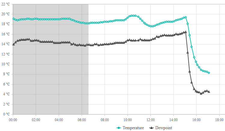
The temperature at O'Hare hit 26.7°C/81°F just before 4pm today. That's a new record:
The National Weather Service recorded a temperature of 80 degrees at O’Hare Airport, surpassing the previous record of 79 degrees set in 1986 and met in 1998, according to NWS meteorologist Mark Ratzer.
But he warned not to get used to the heat.
A cold front heading to the area Tuesday afternoon is expected to cause temperatures to plummet to a low of 37 degrees by Tuesday night. Areas near the lake will likely be cooler than inland areas.
Showers and thunderstorms are also possible in the area early Tuesday and throughout much of the rest of the week. Temperatures rivaling Monday’s record likely won’t return to the area within the next week, according to the Weather Service.
That's right, kids, it's still spring in Chicago. So buckle up for the next few days.
With 44 days to go before I hand over the keys door codes on my house, I looked at one last place today. It's at the north end of the Northalsted/Boystown neighborhood east of Wrigley Field, so the location is fantastic. The unit itself didn't show well at all because the current owners, shall I say, don't seem to have the same standards of maintenance that I do. It's fairly small and I don't think I would like my home-office situation. Disappointing.
What this means, strangely enough, is that I may spend the summer in a compact 1-bedroom rental in Evanston with the bare minimum stuff I need. This will give me time to keep looking for a permanent situation while Cassie gets a whole bunch of new smells to explore. It will also save me a ton of money, while at the same time encouraging me to find the right apartment. And Evanston is delightful in the summer, despite the no-dogs rules everywhere.
Not the most ideal situation, to be sure. And my car is going to live on the street for the first time ever. (There is a car charger two blocks away, however, so I will be able to feed the car from time to time.) The place is also two blocks from Sketchbook Brewing, a top-10 Brews & Choos location, one block from the same Metra line that goes past my current house, around the corner from two independent coffee shops, and three blocks from the place where my mom lived while I was in college and law school. Who knows? I might find my forever home in Evanston while I'm up there.
All of this will happen in the next few days....
Copyright ©2026 Inner Drive Technology. Privacy. Donate!