I've stopped briefly in London to take two days with no responsibility whatsoever. Along the way I got a brief glimpse of Kyiv, but tantalizingly the cloud cover started right over the city. (For the half-hour we flew over Eastern Ukraine the weather was perfectly clear.)
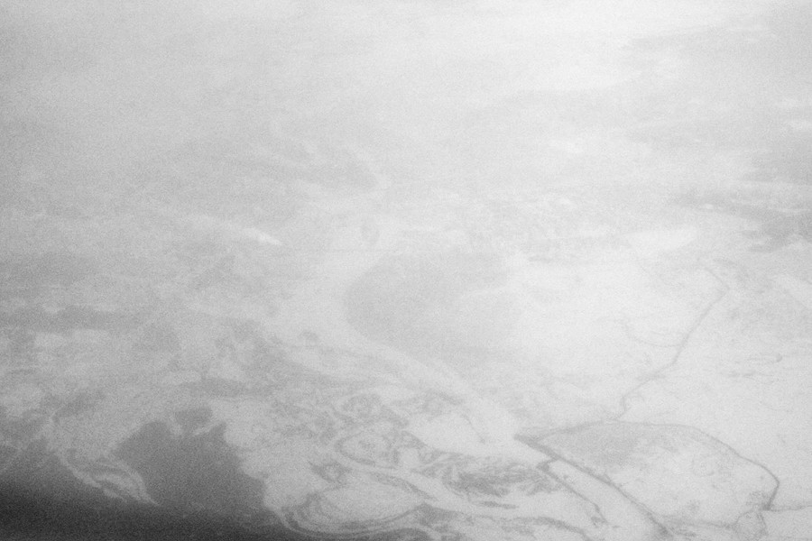
No, really, that's Kyiv:
I'm not entirely sure I'll get back to Chicago tomorrow, though. They're expecting a snowstorm:
The snow may cover the area over a 24-hour period beginning late Monday, according to the National Weather Service Web site.
Much of the area is expected to get a total of 8 to 10 inches of snow, with higher amounts possible near Lake Michigan in Illinois and across Northwest Indiana where lake enhanced and significant lake effect snow might occur.
Now out to breakfast in London.
A group of us went on a tour of Indira Gandhi International Airport today, including the unfinished Terminal 3 building. Sadly, the art and description will have to wait for a bit. My work has piled up (as happens mid-residency) and I have two items due tonight.
One thought, though: if the sun hasn't peeked through the clouds all day in Punxsutawney, how is it possible Phil saw his shadow? I think they're putting words in the groundhog's mouth over there.
After waking up at 4:30 for two mornings in a row, I really would like my body to figure out what time zone it's in. Maybe the problem is the Indian half-hour (it's 11½ hours ahead of Chicago, not 11, not 12), or possibly it was the two overnight flights in a row? Maybe I should just be glad I've had a relatively easy time getting to a point where I go to sleep at night (last night around 9:30pm) and wake up in the morning, instead of the reverse.
Meanwhile, back in Raleigh, it looks like they have some weather this weekend:
Tonight: Snow likely before midnight, then snow and sleet. Low around -4°C. East wind between 13 and 21 km/h, with gusts as high as 40 km/h. Chance of precipitation is 100%. Total nighttime snow and sleet accumulation of 8–12 cm possible.
Saturday: Snow and sleet before 1pm, then freezing rain and sleet. High near -4°C. Northeast wind around 24 km/h, with gusts as high as 47 km/h. Chance of precipitation is 100%. New ice accumulation of less than a 1 mm possible. New snow and sleet accumulation of 8–12 cm possible.
Friends have reported stockpiling mac and cheese and wine. In some respects, I wish I were there. In others...well, it's going to be 20°C and foggy in Delhi today, while we Dukies go out to the Red Fort and Old Delhi.
More, with photos (I hope), tonight.
As "Chicagoans gaze out at a cover of snow for the 21st consecutive day" today, I'm once again in Raleigh, where snow fell once a few weeks ago but decided not to stay the night. It's already 9°C, going up to a predicted 16°C this afternoon. I plan to walk as far as my legs will take me (or Parker's will take him) later on.
That's the problem, of course: in Chicago, we get maybe three days like this between November and March, so I'm a little giddy about it. On the other hand, Chicagoans do get a lot of work done in the winter. Probably because we have no opportunities to play.
Apparently I got back to Chicago just in time for a heat wave:
Arctic air's grip on Chicago's weather enters its 19th day Tuesday. But far-reaching changes in critical upper level steering winds taking place on a continental scale are to undermine the frigid air's dominance. The break in arctic-level temperatures may span much of the coming two weeks. Not until month's end may bitter winds of arctic origin return brutally cold air to the metro area.
Coming days will offer winter weary Chicago area residents a noticeable respite from the bitter air at the heart of January's 13.9-degrees average temperature to date--a reading more than 5°C below normal. But the "warming" predicted which is to include the city's first above freezing afternoon readings since Christmas (Dec. 25), may occur a bit more slowly than many might hope.
Today the temperature at one reporting station (Waukegan) did, in fact, go all the way up to 0.6°C, but alas the city's official high today looks like 0°C on the nose.
Bonus: A propos of nothing, here's a set of outtakes from ABC's Better Off Ted (NSFW). Worth a chuckle.
Via several sites, a NASA photo of Great Britain from Thursday noontime:
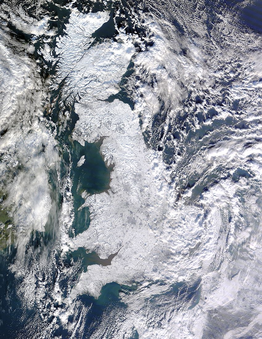
The U.K. doesn't usually get a snow cover at all, let alone one this thorough. The U.K. Met Office has an explanation:
In most winters, and certainly those in the last 20 years or so, our winds normally come from the south-west. This means air travels over the relatively warm Atlantic and we get mild conditions in the UK. However, over the past three weeks the Atlantic air has been ‘blocked’ and cold air has been flowing down from the Arctic or the cold winter landmass of Europe.
But not this:
.jpg)
The Chicago area was bracing for a long, hazardous evening rush hour as it continued to be socked by a major snowstorm that has canceled more than 500 flights, closed more than 150 schools and caused numerous spin-out accidents on expressways.
The Illinois State Police is warning of "extreme travel times" for the rush hour.
Tonight also will turn bitterly cold with wind chill values as low as -17°C to -24°C.
Today's high temperatures are expected to be [around -5°C].
At the peak of the morning rush hour, travel times on some expressways were well over an hour above the norm. Travel conditions are expected to be worse this evening as winds pick up and snow begins to drift across roadways.
Like I said yesterday, Chicago weather builds character—but I have enough for now, thanks.
It turns out, Raleigh isn't that cold. All my life I've just accepted that Chicago winters build character. But I'm not sure anymore, especially after three sunny, 5°C days here while temperatures back home have skulked around -12°C. Then, today, this:
A winter storm warning will be in effect across the Chicago area from this evening through Friday morning.
By the end of that warning, anywhere from 15 to 30 cm of a fairly fluffy snow will have come down, according to the National Weather Service. The heaviest snows are expected near the lakefront.
... The heaviest snowfall will occur between noon and 6 p.m. Thursday, with snow falling at about an inch an hour, [said Charles Mott, a meteorologist with the National Weather Service].
Forecasters predict snow in Raleigh tonight, too: about 1 cm or so. Of course, that amount could halt all commerce in North Carolina, so we'll be stocking up on bottled water later.
Seriously, though, Raleigh averages 19 cm of snow annually; Chicago, 98 cm. Then there are the normal temperatures of both cities. I'll say nothing else right now except that the average January daily high temperature in Chicago is the average January daily low temperature in Raleigh.
Let's see how I like Raliegh in July. But today, it's fine.
Since I'm spending so much time here, I thought I should do a
Raleigh sunrise chart to complement the one
for Chicago. (You can get one for your own location at
http://www.wx-now.com/Sunrise/SunriseChart.aspx.)
An interesting note about 2010: the sunset on November 6th will be the latest sunrise
for most places in the U.S. (7:43 am in Raliegh) until 2021.
|
Date
|
Significance
|
Sunrise
|
Sunset
|
Daylight
|
|
2010
|
|
6 Jan
|
Latest sunrise until Mar. 14th
|
07:26
|
17:17
|
9:50
|
|
20 Jan
|
5:30pm sunset
|
07:23
|
17:30
|
10:07
|
|
17 Feb
|
7am sunrise
|
07:00
|
17:59
|
10:59
|
|
18 Feb
|
6pm sunset
|
06:59
|
18:00
|
11:00
|
|
12 Mar
|
6:30am sunrise
|
06:30
|
18:20
|
11:49
|
|
13 Mar
|
Earliest sunrise until Apr. 26th
Earliest sunset until Oct. 31st
|
06:29
|
18:21
|
11:52
|
|
14 Mar
|
Daylight savings time begins
Latest sunrise until Oct. 22nd
Earliest sunset until Sept. 16th
|
07:28
|
19:22
|
11:54
|
|
17 Mar
|
12-hour day
|
07:24
|
19:25
|
12:01
|
|
20 Mar
|
Equinox 13:32 EDT
|
07:19
|
19:27
|
12:08
|
|
23 Mar
|
7:30pm sunset
|
07:15
|
19:30
|
12:15
|
|
3 Apr
|
7am sunrise
|
06:59
|
19:39
|
12:40
|
|
25 Apr
|
6:30am sunrise
|
06:30
|
19:57
|
13:27
|
|
28 Apr
|
8pm sunset
|
06:27
|
20:00
|
13:33
|
|
3 Jun
|
6am sunrise
|
06:00
|
20:27
|
14:27
|
|
7 Jun
|
8:30pm sunset
|
05:59
|
20:30
|
14:31
|
|
12 Jun
|
Earliest sunrise of the year
|
05:58
|
20:33
|
14:34
|
|
21 Jun
|
Solstice 07:28 EDT
|
05:59
|
20:35
|
14:35
|
|
24 Jun
|
6am sunrise
|
06:00
|
20:35
|
14:35
|
|
28 Jun
|
Latest sunset of the year
|
06:01
|
20:36
|
14:34
|
|
19 Jul
|
8:30pm sunset
|
06:13
|
20:30
|
14:16
|
|
10 Aug
|
6:30am sunrise
|
06:30
|
20:11
|
13:39
|
|
20 Aug
|
8pm sunset
|
06:38
|
20:00
|
13:21
|
|
10 Sep
|
7:30pm sunset
|
06:54
|
19:30
|
12:36
|
|
18 Sep
|
7am sunrise
|
07:00
|
19:18
|
12:18
|
|
22 Sep
|
Equinox, 23:09 EDT
|
07:03
|
19:13
|
12:10
|
|
26 Sep
|
12-hour day
|
07:07
|
19:07
|
12:00
|
|
1 Oct
|
7pm sunset
|
07:10
|
18:59
|
11:48
|
|
23 Oct
|
6:30pm sunset
|
07:29
|
18:30
|
11:00
|
|
24 Oct
|
7:30am sunrise
|
07:30
|
18:29
|
10:58
|
|
6 Nov
|
Latest sunrise until 6 Nov 2021
Latest sunset until Mar 7th
|
07:43
|
18:15
|
10:32
|
|
7 Nov
|
Standard time returns
Earliest sunrise until Mar 3rd
|
06:44
|
17:14
|
10:30
|
|
23 Nov
|
7am sunrise
|
07:00
|
17:04
|
10:04
|
|
5 Dec
|
Earliest sunset of the year
|
07:11
|
17:02
|
9:51
|
|
21 Dec
|
Solstice, 18:38 EST
|
07:22
|
17:05
|
9:43
|
You can get sunrise information
for your location at wx-now.com.