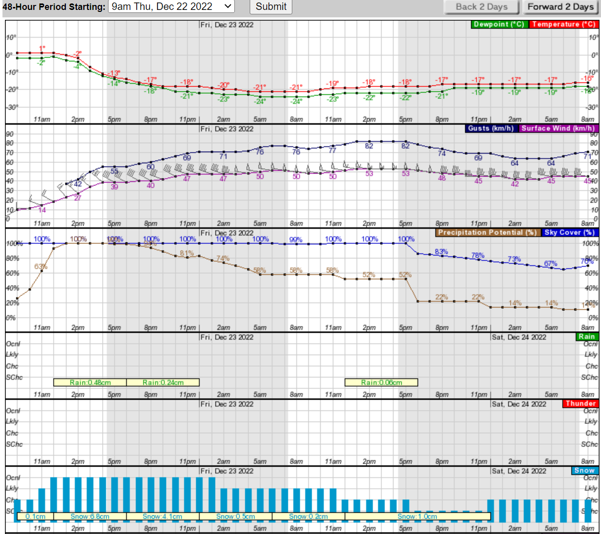
In the last 24 hours, the temperature forecast hasn't changed but the snow forecast has:
Right now it's a calm, overcast 0°C. But then we have this from the National Weather Service:
Today
Snow, mainly after 11am. The snow could be heavy at times. Areas of blowing snow after 3pm. Temperature falling to around -13°C by 5pm. Wind chill values as low as -25°C. Breezy, with a southwest wind 10 to 20 km/h becoming northwest 30 to 40 km/h. Winds could gust as high as 55 km/h. Chance of precipitation is 100%. Total daytime snow accumulation of 5 to 9 centimeters possible.Tonight
Snow. Widespread blowing snow, mainly after midnight. Low around -21°C. Wind chill values as low as -37°C. Windy, with a west northwest wind 40 to 45 km/h increasing to 45 to 50 km/h after midnight. Winds could gust as high as 75 km/h. Chance of precipitation is 100%. New snow accumulation of 3 to 7 centimeters possible.Friday
Snow showers likely, mainly before noon. Widespread blowing snow. Cloudy and cold, with a high near -17°C. Wind chill values as low as -37°C. Windy, with a west wind 50 to 55 km/h, with gusts as high as 80 km/h. Chance of precipitation is 60%. New snow accumulation of less than one centimeter possible.Friday Night
Isolated snow showers before midnight, then scattered flurries after midnight. Widespread blowing snow. Mostly cloudy, with a low around -18°C. Wind chill values as low as -33°C. Windy, with a west wind 40 to 50 km/h, with gusts as high as 80 km/h. Chance of precipitation is 20%.
Ah, but here's the Chicago in December part: the forecast for next week says we could see temperatures jump to 10°C by Friday. Welcome to the land of building character.
At least the streets will probably get cleaned by Friday morning. (Chicago's Streets & Sanitation knows what they're doing.)
Copyright ©2026 Inner Drive Technology. Privacy. Donate!