They just launched high-resolution aerial photos of another batch of cities:
Improving the availability of more high quality imagery is one of the many ways we’re continuing to bring you the most comprehensive and accurate maps of the world. In this month’s update, you’ll find another extensive refresh to our high resolution aerial and satellite imagery (viewable in both Google Maps and Google Earth), as well as new 45 degree imagery in Google Maps spanning 30 new cities.
Google Maps and Earth now feature updated aerial imagery for more than 20 locations, and updated satellite imagery for more than 60 regions. Here are a few interesting locations included in our latest release.
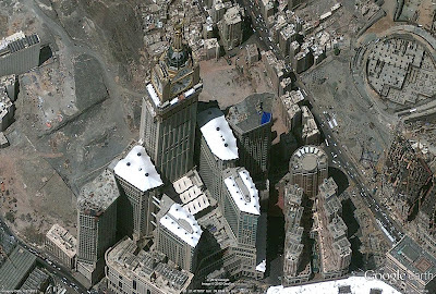
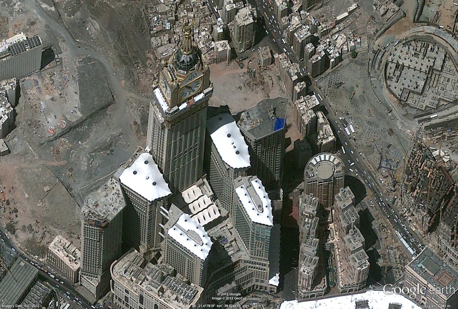
Below is imagery of Mecca, Saudi Arabia where each year more than 15 million Muslims visit this important religious site. Here you can see Abraj Al Bait, one of the world largest clock towers, visible even from space!
Pretty soon they'll have photos of every square meter of the planet—at 10-cm resolution. I find it both really cool and really creepy. As long as they don't have near-real-time photos...
Copyright ©2026 Inner Drive Technology. Privacy. Donate!