Hurricane Ian has made landfall over Tampa, Fla., as a strong Category-4 storm:
In a 3:05 p.m. update, the National Hurricane Center said the massive Category 4 storm made landfall on the southwest coast with 240 km/h maximum sustained winds. The most immediate and life-threatening concern was storm surge — the waters of the Gulf of Mexico pushed inland by Ian.
The surge predictions from the National Hurricane Center soared overnight to 4 to 6 meters for Englewood to Bonita Bay, a forecast so high a new color was added to the National Hurricane Center’s peak storm surge prediction map. The worst of that storm surge is expected after landfall and later this evening.
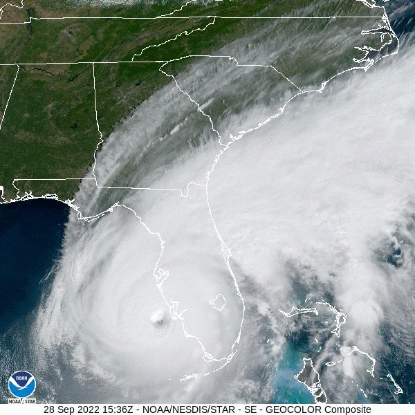
Here is the GOES-East satellite image for the past 4 hours:
I have friends in Tampa and Orlando I'm keeping tabs on. I hope they're all right as the storm moves (very slowly) north. Currently, the probability cone has the storm also hitting just west of the RDU area as a tropical depression. As my (Hungarian) primary flight instructor often said all those years ago, "it mights gonna to be a bit vindy."