The decennial update of the 30-year US climate normals dropped this afternoon. They show the US has gotten measurably warmer over the 1981-2010 normals:
NOAA’s new U.S. Climate Normals give the public, weather forecasters, and businesses a standard way to compare today’s conditions to 30-year averages. Temperature and precipitation averages and statistics are calculated every decade so we can put today’s weather into proper context and make better climate-related decisions.
Normals are not merely averages of raw data. Thirty years of U.S. weather station observations are compiled, checked for quality, compared to surrounding stations, filled in for missing periods, and used to calculate not only averages, but many other measures. These then provide a basis for comparisons of temperature, precipitation, and other variables to today’s observations.
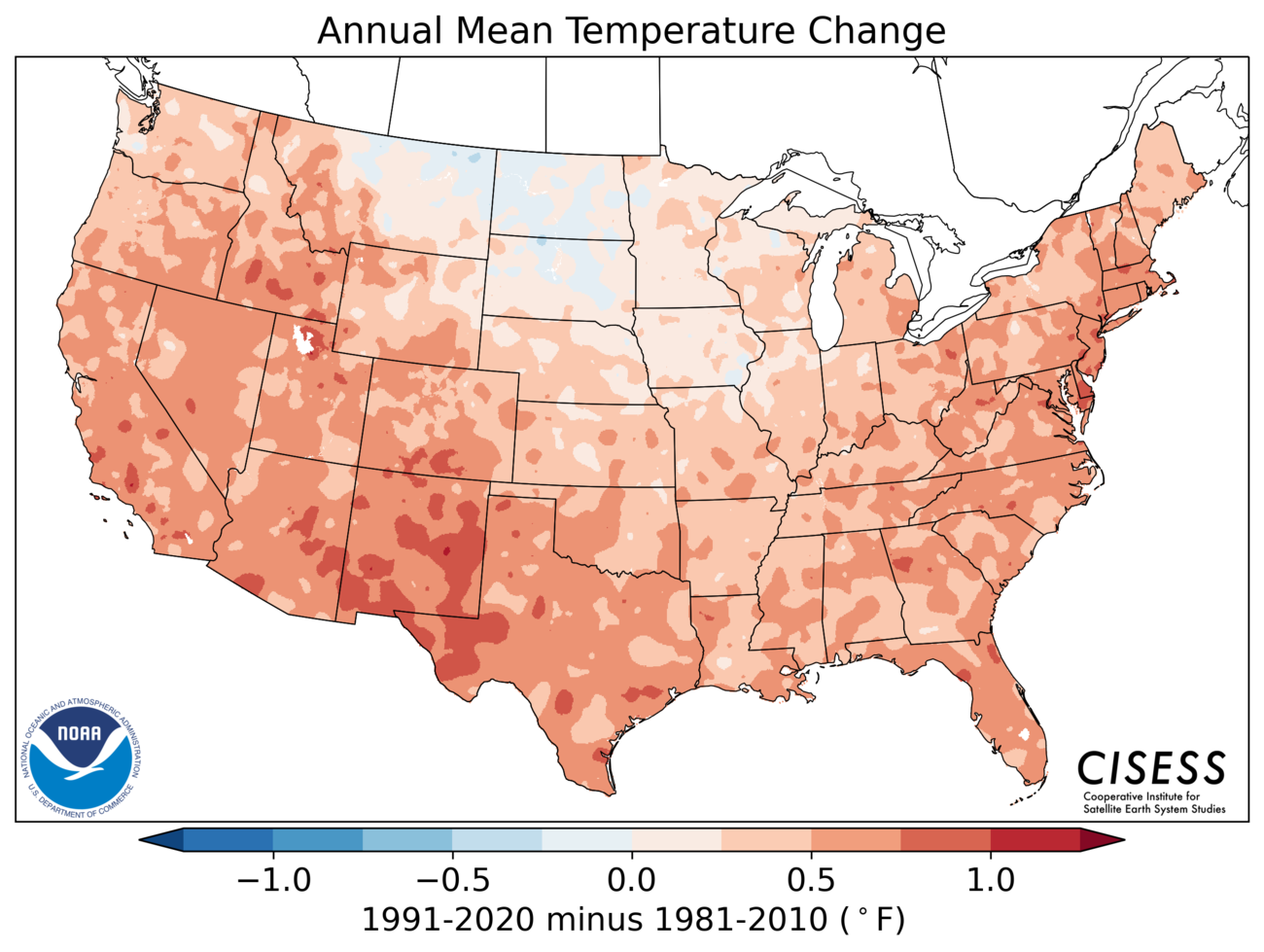
As anticipated, changes have occurred in averages since the last ten-year update.
For instance, the north-central U.S. Temperature Normals—for those in the Northern Plains and Upper Midwest—have cooled from 1981–2010 to 1991–2020, especially in the spring. The South and Southwest are considerably warmer. Normals were also generally warmer across the West and along the East Coast.Precipitation-wise, the Southwest was drier; wetter averages emerged in the U.S. east of the Rocky Mountains, especially the Southeast in the spring.
[L]ong-term trends from decade to decade can affect baseline “normal” weather conditions. For instance, the last decade includes the warmest seven years on record for the globe, according to NCEI.
Chicago got just a little warmer and just a little wetter, as anticipated. Southwest Texas got much warmer and dryer. And Florida is still part of the US. Two of these things are suboptimal.
And if you aren't sure climate change is happening, check this out:
.png)