 Via the Chicago Tribune, NASA launched a new weather satellite in October that provides incredible high-resolution images of the planet:
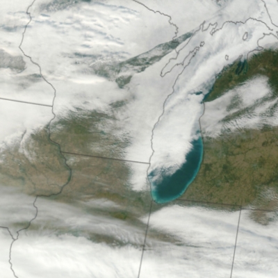
VIIRS will collect radiometric imagery in visible and infrared wavelengths of the Earth's land, atmosphere, and oceans. By far the largest instrument onboard NPP, VIIRS weighs about 556 pounds (252 kilograms). Its data, collected from 22 channels across the electromagnetic spectrum, will be used to observe the Earth's surface including fires, ice, ocean color, vegetation, clouds, and land and sea surface temperatures.
During NPP's five-year life, the mission will extend more than 30 key long-term datasets that include measurements of the atmosphere, land and oceans. NASA has been tracking many of these properties for decades. NPP will continue measurements of land surface vegetation, sea surface temperature, and atmospheric ozone that began more than 25 years ago.
NASA has more information about the satellite mission and a gorgeous photo (8MB jpeg) of the East Coast.