Just now, at Inner Drive Technology World Headquarters:
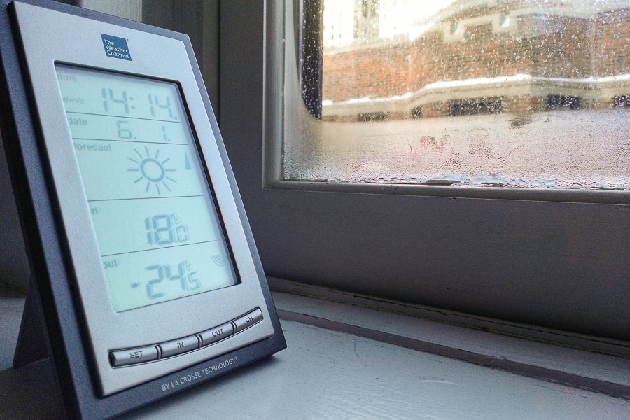
(Compare with four years ago, when I bought the thermometer while sojourning in North Carolina.)
The official temperature at O'Hare is -27°C, breaking the previous record of -25°C set in 1988. We might even break the record low maximum temperature—the coldest high temperature ever on this date—of -18°C set in 1912.
I have not gone outside today, and until I take Parker out after he gets back from day care, I have not plans to do so.
At least the cold snap will be brief; they're forecasting above-freezing temperatures by Friday.
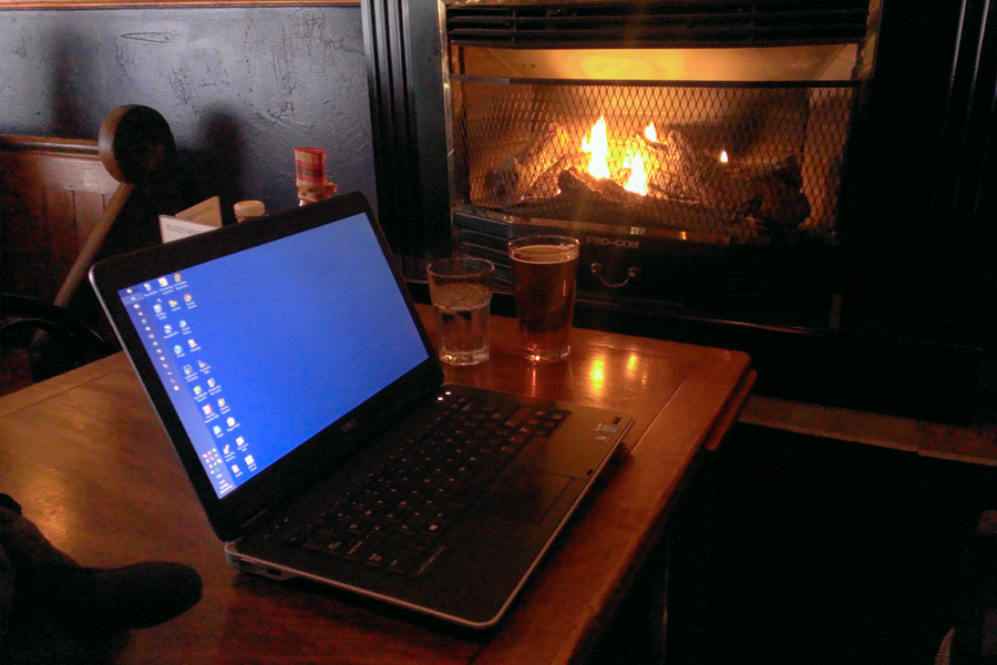
I've gone to my remote office to do some work. Unfortunately, they wouldn't let me sit in the beer garden:
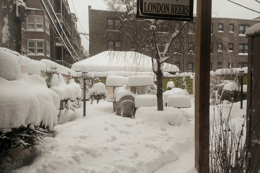
Fortunately, I found an acceptable seat inside:
My real office is closed tomorrow because no one wants to commute on the coldest day since 1995. I hope something is open. Or at least, I hope someone delivers.
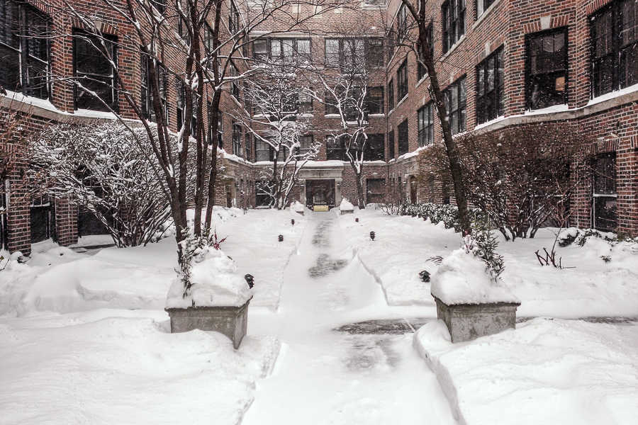
The snow has fallen for about 20 hours straight. We're still enjoying it, mostly, because it's Sunday morning and not everyone has put pants on yet. (Parker insists I put pants on every morning by 8. He still hasn't learned how to put on his own leash.)
So it's still kind of pretty:
As I sit in my (eerily quiet) apartment Inner Drive Technology World Headquarters, watching the snow swirling around out there, I am very glad I replaced my windows and have a washer and dryer inside. I'm not pleased that my favorite boots have started to leak. And I'm not looking forward to tomorrow's weather.
We proudly welcome the oncoming polar vortex tomorrow evening:
The polar vortex is an area of cold low pressure that typically circulates around the Arctic during the winter, spreading tentacles of cold southward into Europe, Asia, and North America at times. Except this time, it’s not a small section of the vortex, but what one forecaster, Ryan Maue of WeatherBELL Analytics, called “more like the whole enchilada” [that's visiting the eastern U.S.]
The Chicago Weather Center predicts starting Sunday night “a non-stop 60 hour stretch of temperatures which fail to break above 0-degrees” – the longest such period of the past 18 years.
The core of the cold reaches the Ohio Valley and East Coast Monday night into Tuesday, when temperatures drop 20 to 40+ degrees below normal.
The cold air will slowly begin retreating Wednesday.
Here are the temperature, wind, and precipitation probability graphs for the next 48 hours (click for full size):
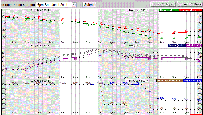
The next 48 hours look almost as bleak, with the temperature line staying below -18°C until around midnight Wednesday. Strangely enough, it just keeps going up from there, hitting the freezing mark on Friday morning.
So: two days of the coldest air anyone has experienced in Chicago since the 66 hour stretch we had in February 1996.
Can't wait.
At least, it's sunny and warm in my office. Outside it's sunny and -18°C. I experienced what may be characterized as a "brisk" walk from the bus this morning.
This, believe it or not, will lead to a brief respite from the winter we didn't really expect. The Tribune reports this morning that the 50 hours of snowfall we had earlier this week put down more snow than any other storm since February 2011. It gets better:
There’s plenty of snow to blow around. The 620 mm on the books to date for the 2013-14 Chicago snow season is the heaviest tally this early in 13 years. What’s more, the 50 hours of “on and off” snowfall, which began Tuesday (New Year’s Eve) afternoon, had by late Thursday produced the biggest accumulation of snow here since the February Ground Hog’s Day Blizzard in 2011.
Midway Airport was home to a 312 mm storm total the past 3 days while O’Hare checked in with 277 mm. Amounts were even more impressive north and west of the city. There, as much as 450 mm fell at Arlington Heights and Gurnee....
Oh, but wait for it:
Bitterly cold air is to come crashing southward into the Lower 48 over the weekend, producing wind chills as low as -60°C in northern Minnesota by Sunday morning. That level of chill is occurring as a brutally cold air mass proceeds south from Canada, breaking a host of temp record records on the way, and producing a non-stop 60 hour stretch of temperatures which fail to break above 0-degrees. That would be the longest sub-zero [Fahrenheit] period of the past 18 years.
Monday's forecast calls for a high around -22°C and a low around -27°C outside the city and -24°C overnight.
For some reason, the Climate Prediction Center believes we'll have above-normal temperatures shortly after that. One can dream...
My walk to the bus this morning, through a park path that I forgot they don't shovel:

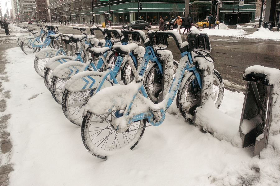
I could have taken a Divvy bike but...well, for some reason they're closed today:
The good news is, it's stopped snowing for now. The bad news is, we're heading down to -17°C tonight.
I texted some friends in Atlanta and Houston with the top photo. For some reason they don't want to visit Chicago just now.
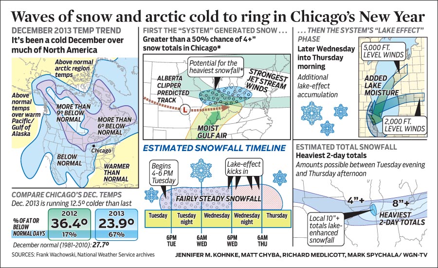
Here's the Tribune's weather infographic for today:
The warmer-than-normal temperature formerly over Alaska has now swung around into the arctic, dragged by a persistent high pressure over the pole. That's pushing cold air down into the Prairie Provinces and the upper Midwest. Meanwhile, warmer-than-normal temperatures over the south-eastern U.S. and Caribbean is dragging moisture right over the lower Midwest.
Consequence: it's -12°C here right now, and in 36 hours we'll have 250 mm of snow.
We're getting a real winter this year. W00t. :/
Astronomical winter officially begins tomorrow at 11:11 CST. But as anyone in the Midwest can tell you, meteorological winter began three weeks ago.
The Chicago Tribune has a nice, clear graphic today showing the problem:

The late, strong Alaska block this year is almost certainly hanging around because of anthropogenic climate change. Usually by this point the North Pacific has cooled enough not to drag the mid-latitude jet stream all the way up to the Arctic.
Welcome to the new climate.
Eventually, average temperatures will likely increase the Gulf of Mexico's persistent high pressure area such that the mid-latitude jet stream doesn't get as far south as Chicago during the winter. At that point our winters will likely be wetter and warmer, more like North Carolina's. Meanwhile, though, we're likely to have a frickin' cold winter, one hopes followed by a cooler summer due to a cooler lake.
Yes. And snowy:
Snowfall’s been quite relentless here. Flurries (or more) have fluttered to earth 8 of the past 9 days. And, with just under 250 mm on the books to date, the 2013-14 season has been accumulating snow at nearly twice the normal pace and ranks 33rd snowiest of the past 128 years. That places it among the top quarter of all Chicago snow seasons since records began here in 1884-85.
There’s been only one day with a temperature even briefly above freezing in the past 12. An eight day string of above freezing readings came to an end after a November 28 through December 5th run.
This coming week will see some warming, and possibly a few days above freezing starting tomorrow afternoon. Then Monday we'll see more frigid weather coming in behind either a snowstorm (according to European models) or a dusting (according to American models).
You know, I don't mind a few weeks of this every year, particularly if we don't see it until January, like last year. But this? Snow and sub-freezing temperatures for most of December? I'm not looking forward to three months of this crap.
At least the lake will be cooler come June, which should moderate our summer. Still: before Chicago's climate gets consistently warmer in a few decades, we'll keep having crushingly cold winters alternating with warm ones. I can't be sure this is an improvement.
After a string of days when the temperature was so low even Parker didn't want to go outside, this morning's -4°C felt downright balmy.
Of course, it's warming up ahead of the 15 cm of snow forecast for tonight.
Looks like we're getting a real winter this year.