Two photos from Caribbean islands that will probably never look this way again.
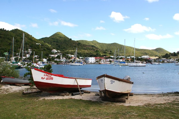
Sandy Ground, St. Martin, February 2009:
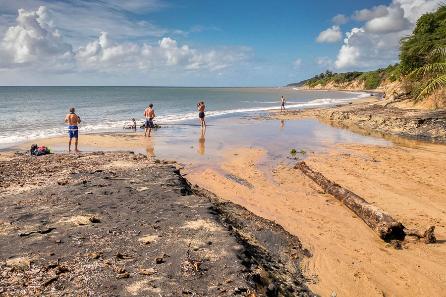
Playa Negra, Vieques, Puerto Rico, November 2016:
I hope they can rebuild quickly.
Hurricane Maria's eye passed directly over Vieques earlier this morning and has now struck Puerto Rico proper:
Hurricane Maria roared ashore Wednesday as the strongest storm to strike Puerto Rico in more than 80 years, knocking out power to nearly the entire island and leaving frightened people huddled in buildings hoping to ride out withstand powerhouse winds that have already left death and devastation across the Caribbean.
The storm first slammed the coast near Yabucoa at 6:15 a.m. as a Category 4 hurricane with 250 km/h winds — the first Category 4 storm to directly strike the island since 1932. By midmorning, Maria had fully engulfed the 160-km-long island as winds snapped palm trees, peeled off rooftops, sent debris skidding across beaches and roads, and cut power to nearly the entire island.
In an unfortunate twist, some residents of Vieques had stocked up on critical supplies in advance of Irma only to donate what they had left to harder-hit areas such as Tortola and St. Thomas. Residents rushed to restock before deliveries to the island stopped and the power flickered off yet again.
There isn't much news coming out of Vieques yet, but having been there less than a year ago, I can't imagine that much of it remains standing. The shops and restaurants on Calle Flamboyan are (were?) less than 50 m from the beach, and barely 3 m above the Caribbean. I hope everyone got out OK.
This hurricane season may not break records for numbers or aggregate storm severity, but it will probably do so for destruction and cost. With St Martin and Barbuda all but destroyed, it looks like Vieques and Culebra are next:
Hurricane Maria went through an astonishingly quick transformation from a minimal hurricane to a Category 5 monster in less than 24 hours. As of 9 p.m. ET [Monday], Maria had maximum sustained winds of 250 km/h, and the island of Dominica was right in the path of the worst of the storm's winds.
The National Hurricane Center has warned Maria is now a "potentially catastrophic" storm. This is the only Category 5 storm to strike Dominica on record, and may be among the fastest rates of intensification of any hurricane on record.
The National Weather Service office in San Juan issued a statement on Monday afternoon warning of the massive threat this storm poses to the island. The winds alone could cause locations to be "uninhabitable for weeks or months," the Weather Service stated, in addition to warning of a potentially deadly storm surge along the coast.
I visited Vieques in November, and I've visited St Martin twice before. I hope both islands recover quickly.
Note to Scott Adams and other climate-change deniers: The intensity and destruction of this year's hurricanes don't prove human-caused climate change. They are predicted consequences of human-caused climate change. By "predicted" I mean that, 20 or 30 years ago, climatologists warned this is exactly what would happen as the planet got warmer.
Historian John Schmidt posted today about the 11 most-mispronounced street names in Chicago:
(1) Devon. Like those posts note—and like most Chicagoans I know—I pronounce it dee-VAHN.
(2) Leavitt. Forget the part that looks like “leave.” It’s LEV-itt.
(3) Paulina. Not pronounced like the girl’s name. The street is pull-EYE-nuh.
That last one is part of a joke: What are the three street names that rhyme with female anatomy? Paulina, Malvina, and Lunt.
It also reminds me of Yuri Rasovsky's infamous 1972 recording, "The Chicago Language Tape:"
Not many of those street names sound like that after 45 years. But it's still hilarious if you're familiar with the city.
The science of modeling hurricane storm surges started here in Chicago after the seiche of 1954:
When the surge hit Chicago, it hit a city that housed one of the world’s great meteorology departments, at the University of Chicago. One of its professors was the meteorologist George Platzman....
The meeting of those two freak concepts—real but rare deadly Great Lakes storm surges, and the bizarre possibility of an atomic bomb detonating in Lake Michigan—along with his computer-forecasting experiments, led Platzman to take up the nonexistent science of storm-surge prediction, beginning with an attempt to reverse-engineer the 1954 tragedy. His first model, in 1958, got the timing right, but was off by half on the height of the surge; nonetheless, it was used to accurately predict a 1960 Lake Michigan storm surge on Chicago, resulting in a public warning that may have saved lives.
Five years later, Platzman published a much more ambitious run at the phenomenon, crunching 20 years of hourly wind and water-level data at six weather stations on Lake Erie. He also used a much more sophisticated model than his 1958 study—which didn’t include wind stress—a level of complexity only possible in the computer age. And it worked, with an accuracy of about 90 percent.
The models improved into today's SLOSH model, which meteorologists have been using with abandon the past two weeks.
Dutch Prime Minister Mark Rutte said yesterday that Hurricane Irma caused "enormous devastation," leaving the island without gas or electricity:
Most communications with the outside world are being conducted via the military, he said, adding that there was “no clarity” on victims.
The Dutch navy, which has two ships stationed off the coast of the island, tweeted images gathered by helicopter showing damaged houses, hotels and boats.
French authorities have counted at least eight dead on the French side of the island.
.jpg)
Photo of Princess Juliana Airport, looking south; Dutch Dept. of Defense.
An official said that 95% of the island was destroyed, rendering the island uninhabitable.
Irma's winds, estimated at 280 km/h when it hit St Martin, mean it had the strength of an EF4 tornado.
And Hurricane Jose, with sustained winds of 240 km/h, is forecast to hit St Martin by 8pm AST tomorrow—about 12 hours before Hurricane Irma hits Florida head-on.
I've visited St Martin/Sint Maarten twice, once in 2009 and again in 2014. It's unclear when I or anyone will spend a vacation there in future, because this morning the strongest hurricane ever recorded in the Atlantic smashed directly into the island.
At 8:43 AST, the Guardian posted these videos.
Twitter user Kurt Siegelin posted this video at 9:12 AST.
As of 9:30 AST,
French Interior Minister Gerard Collomb also said that government buildings on the island of Saint Martin - the most sturdy built there - had been destroyed.
“We know that the four most solid buildings on the island have been destroyed which means that more rustic structures have probably been completely or partially destroyed,” he told reporters.
Meanwhile, Puerto Rico is bracing for impact as most models forecast the eye to pass just north of San Juan: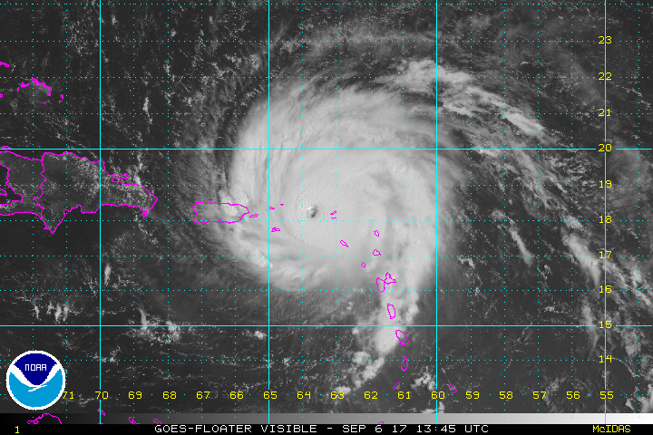
This is the first Category-5 storm to hit Puerto Rico since 1928, and is significantly more powerful.
The forecast track puts the storm in South Florida on Sunday.
Meanwhile, Tropical Storm Jose is right behind Irma, but forecast to pass northeast of the Windward Islands over the weekend. And Tropical Storm Katia is about to blow across southern Mexico.
I'll be following all three closely this week.
A new paper in the journal Theoretical and Applied Climatology tries to replicate the most-referenced papers in the 3% minority that find alternate explanations for human-caused global warming. Turns out, the deniers are still looking for their Galileo:
This new study was authored by Rasmus Benestad, myself (Dana Nuccitelli), Stephan Lewandowsky, Katharine Hayhoe, Hans Olav Hygen, Rob van Dorland, and John Cook. Benestad (who did the lion’s share of the work for this paper) created a tool using the R programming language to replicate the results and methods used in a number of frequently-referenced research papers that reject the expert consensus on human-caused global warming. In using this tool, we discovered some common themes among the contrarian research papers.
Cherry picking was the most common characteristic they shared. We found that many contrarian research papers omitted important contextual information or ignored key data that did not fit the research conclusions.
We found that the ‘curve fitting’ approach also used in the Humlum paper is another common theme in contrarian climate research. ‘Curve fitting’ describes taking several different variables, usually with regular cycles, and stretching them out until the combination fits a given curve (in this case, temperature data). It’s a practice I discuss in my book, about which mathematician John von Neumann once said, "With four parameters I can fit an elephant, and with five I can make him wiggle his trunk."
This represents just a small sampling of the contrarian studies and flawed methodologies that we identified in our paper; we examined 38 papers in all. As we note, the same replication approach could be applied to papers that are consistent with the expert consensus on human-caused global warming, and undoubtedly some methodological errors would be uncovered. However, these types of flaws were the norm, not the exception, among the contrarian papers that we examined.
You can count the insurance industry among the groups that believe the science is settled. Insurers appear to have started looking at climate change as an inevitability, not a risk, which changes their models radically:
[F]lood insurance was not a lucrative business to begin with. Congress set up the National Flood Insurance Program in 1968 as it became clear that private companies couldn’t profitably provide coverage. Now, nearly half a century later, the program is—ahem—under water by $24.6 billion. As a result, there’s a push to move flood insurance toward the private market. That could mean less building in flood-prone areas, as they become effectively uninsurable thanks to sky-high rates. Says Morningstar’s Brett Horn: “Frankly, that’s not a bad outcome.”
Meanwhile, the second major hurricane of the season is heading for Florida...
I'll just levee where I foundee.
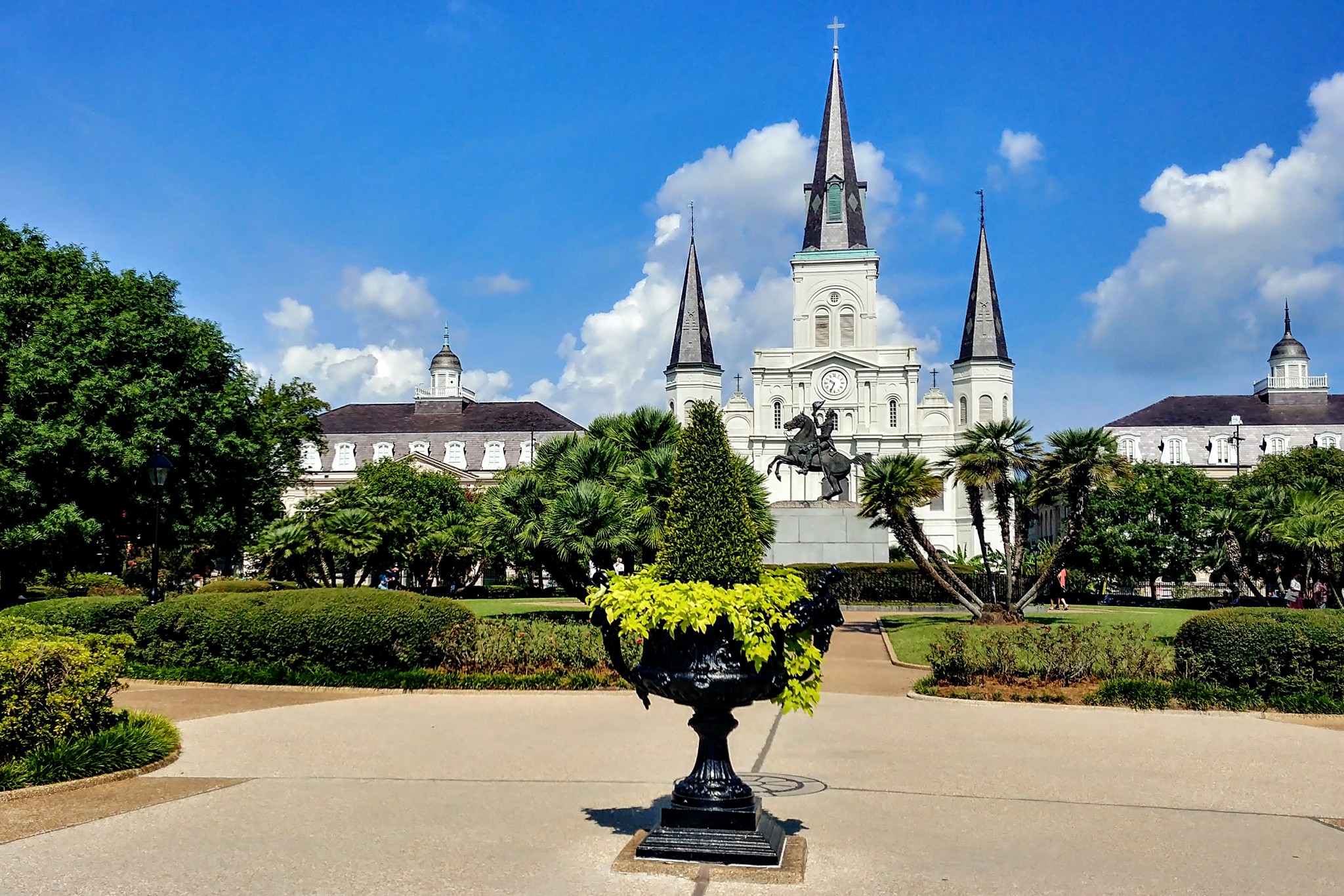
Jackson Square, New Orleans, where it's currently 32°C: